Timeline Project Trilogy

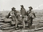
I have set up the third and final (for a while at least) of the sites devoted to geographical and chronological mapping of historical conflicts. Not that I need an additional time sink but the compulsion to add an American Civil War Project was irresistible.
That fact that I now have a Trilogy of sites is purely coincidental. My nauseatingly sycophantic obsession with StackOverflow can only go so far ... hmmm
Anyway, I have three projects ready for user contribution. Although I quite enjoy doing the research and populating data points myself, I do occasionally, quietly hope that some generous denizen of the Internetz will log in and contribute their valuable time to one of my three digital offspring:
- The World War Two Timeline Project
- The Napoleonic Wars Timeline Project
- The American Civil War Timeline Project
Permalink - Comments - Tags: Development,World War Two,Napoleonic Wars,American Civil War
August 1940

I have alternatively made progress and had setbacks in the last few days. First the progress:
I am finding the new interface really streamlined for creating content and have finished entering data points up to August 1940 in Europe. The battle for France has ended, the Italians have entered the war and the Battle of Britain has just begun, it is a fascinating period to be reading about. I would love to get hold of a book on the Battle of Britain to improve the geographical data I have entered for the various phases of that conflict.
The setbacks:
First I discovered that the datapoint creation form was badly broken in Internet Explorer 7. Fixing this will involve a painstaking process of elimination to find the CSS at the root of the problem. I then discovered that the main Timemap interface was broken on all versions of IE, this is a much more serious. I haven't had a chance to investigate yet, but I am confident that this problem will not be too complicated to resolve.
Update : The second problem with the main interface is fixed now. Turns out I was generating some invalid JSON for polyline type markers on the map. Now I just have to fix up entry creation interface for IE7.
Permalink - Comments - Tags: Development,World War Two
Timeline Project Developer Diary

Now that the content creation interface is getting more mature, I have decided to go back to entering data for the site. There are a couple of good reasons to do this:
- Populating a quality data set is the fundamental reason that I started the project.
- Eating my own dog food is a great way to find problems with the UI.
Unsurprisingly, apart from entering some more data for the Battle of France, I found a few problems with the UI that I have tried to address:
GeoCoding AJAX in the UI
Often (but obviously not always) new datapoints have a pretty easy to find location. London for De Gaulle's first radio address after the fall of France or Paris for the German occupation of that city in June 1940. I found myself switching to Wikipedia to look up those locations, finding the coordinates and then copy/pasting them into the text boxes in the UI. This was pretty clumsy and I realized I could just do the lookup myself using the Google GClientGeocoder. I have added a search box so that a user can type in a name, do a search and update the latitude, longitude accordingly. I love how this turned out and it really streamlines datapoint creation process:

Check for duplicates
I have a text file of data points that I had created early on in the project (and was previously importing into the database with a Python script). I have been slowly going through that file, using the UI to enter the data. I haven't been to careful about keeping track of where I was up to and have consequently entered a couple of data points twice. This was pretty annoying and I realized a simple solution to the problem would be an AJAX based check for duplicates as soon as you enter a start and end date. This was inspired mostly by what Stack Overflow does when you create a new question:

Implementing this feature involved a bit of learning curve to understand how the MooTools Request object worked, but in the end it was pretty straight forward.
Permalink - Comments - Tags: Development,World War Two,Napoleonic Wars
Timeline Project Comments

I have implemented a comment stream for each data point in the system. There is still a long list to todos and probably a longer list of bugs, but I feel like I am making some progress:
- I need to a better job of filtering datapoints in the page. Rather than doing a reload from the right hand tag menu.
- I need to scroll the timeline to a data point based on the id.
- I would like the ability to flag data points as offensive,inaccurate. I would like the entry page for each data point to reflect the number of flags.
- I would like to create user badges/achievements based on what the user does in the system. This inspired by the X-Box achievements system via StackOverflow.
- I realised today that it would be handy to do a GeoCoding request based on a city name typed into the edit/create entry forms. I often found myself doing a search on wikipedia, going to the geocoding page and then copy/pasting the latitude, longitude. This could mostly be automated in the form.
- I have clarified the tags for each data point, but they are still not perfect. I need to remove the theater option for The Napoleonic Wars. I also should get rid of the War, it is not really useful.
- I need to clean up the info window dialogs on the map. They are ugly at the moment and they need links to the edit page and discuss page.
- Check out the details for licensing the data as CC WIKI.
Permalink - Comments - Tags: Development,World War Two,Napoleonic Wars
Timeline Project FAQ
So I thought I needed some kind of FAQ to introduce new users to my collaborative Timeline Project. This is something I will build upon over time:
- What was the motivation for the site?
- Where do I signup to contribute?
- Why the Wikipedia link?
- What are the tags for?
- Land - Any combat that involves land based forces (infantry, cavalry, artillary, armour etc...) should include this tag.
- Naval - Any combat that involves naval units should include this tag.
- Aerial - Any combat that involves planes should include this tag.
- Airborne - Any combat that involves airborn troops (paratroopers), should include this tag.
- Domestic - Any event that is purely concerned with the internal infrastructure of a particular country should include this tag.
- Diplomacy - Any event that involves some kind of negotiation between two or more nations should include this tag.
- International - Any event of significance to many nations should include this tag.
What was the motivation for the site?
While digging around in my attic some time late last year, I discovered a fold out Timeline of World War Two that had been a birthday present some years ago. It inspired me to investigate if this sort of information, in this format, was available on the Internet. I discovered that although there is a wealth of websites describing lists of events in great detail (Wikipedia being the most impressive), this particular presentation of the information (a scrolling timeline of events) was either not available or buried so deep in Google that I didn't uncover it.
What I did discover was an amazing programming tool which marries a scrolling dynamic Timeline (almost exactly what I had envisaged) with a Google map. The addition of geographic information to my original concept of a Timeline sealed my fate. Mapping historical events in time and space has become my new obsession.
Where do I sign up to contribute?
You can now sign up for an account and start entering data.
Why the Wikipedia link?
Because of the limited space available for each map point, I wanted to provide the ability to link to a more expansive explanation for the data point. Wikipedia provides, in my opinion, the best collection of articles, maps and documents to describe the data that will be added to the Timeline system. I have mandated the inclusion of a Wikipedia link to ensure that users will always have an easily accessible link to more information if they require it.
What are the tags for?
Probably the most initially confusing aspect of the Creation/Editing User Interface is the addition of tags to new data points. Tags are a set of annotations associated with a data point that allow users of the site to sort the data in useful ways. Tags also include the countries (or states) involved in any data point in the system. Here is the current list of applicable tags and their descriptions:
You will notice that you can apply more than one tag to a data point and you should include any and all tags that are applicable to the data you are adding to the system. The first tag is a special tag that is used to color the entry on the map. You should use the most significant tag first.
More questions/answers coming ...
I still have a list of features that I would like to implement and the project is still very much in BETA. I would appreciate any suggestions or corrections you might have. You can email me at .
Permalink - Comments - Tags: Development,World War Two,Napoleonic Wars,American Civil War
[First Page] [Prev] Showing page 3 of 4 pages [Next] [Last Page]
 Mastadon
 Feeds
Feeds Contribute