Jack Aubrey as the Reddit alien

A small thank you for the kind words from those lovely folks over at the Aubrey Maturin Sub Reddit .
Permalink - Comments - Tags: Patrick O'Brian,Art?
Mapping of The Ionian Mission Complete
My map of the events in The Ionian Mission is complete. From blockade in the Worcester, a return to dear Suprise and an encounter with the three Beys.
When I finished The Surgeons Mate, after an 18 month slog on that book, I decided to make a concerted effort to finish this one sooner. I am as proud as Lucifer (upon my soul) that my schedule of weekly updates has allowed me to finished this map in a year and a day. There was lots of guess work on this one, with fictional ports from the north coast of Africa to the Ionian shore, but I hope my logic has resulted in charts that reflect the events reasonably well.
I have linked to Charles Keller's wonderful map and article of the Torgud, Kitabi & Suprise engagement, as it was a huge help in the final stages of the book. Although I differ slightly with him on the location of that battle.
At this prodigious rate I will be finished in eleven years, so on to Treason's Harbour. Wish me luck.
Permalink - Comments - Tags: Patrick O'Brian,Books
Patrick O'Brian Mapping Project Sponsorship
I am very happy to announce that Art Marine has decided to sponsor the Patrick O'Brian Mapping Project. I have spent the last five years working on my site and their help is very much appreciated.
If you are a fan of Patrick O'Brian or the Napoleonic age of sail, you should go and check out some of their amazing prints, Remarques and oil paintings.
Permalink - Comments - Tags: Patrick O'Brian
Mapping of the Surgeon's Mate Complete
The events of The Surgeons Mate, rescue by HMS Shannon, a long chase in The Packet Diligence and the final voyage of the HMS Ariel, is complete.
Over a year and a half ago, having taken an unprecedented eight months to map The Fortune of War, I had anticipated:
I hope my distracting forays into other projects will be less frequent for the next one.
Instead, I have managed to distract myself with more and more projects and found myself with less time to work on mapping the cannon than I would like. Despite the distractions, The Patrick O'Brian Mapping Project remains a priority and in the last few months I have managed to build some features that I am very happy with:
- POB Quotes - A free iPhone application to view a selection of quotes and maps from the project.
- Google Maps Version Three - In May, Google announced that the new version of the Google Maps API would replace version two as the production API. Ever since then I have been meaning to upgrade the rather archaic implementation of the project. I managed to do most of this at the recent Google DevFest in Sydney. As of today, that new version is live on the site and you will notice a new look and feel for the maps. I would love to hear your feedback on the new and (hopefully) improved Patrick O'Brian Mapping Project.
- New backend architecture - Part of the work to move over to version three of the maps API involved changing the way the data is stored in the project. You will now find that links to individual map notes (from the title of the map popups) will be more reliable.
Once again I will optimistically declare that the next book will surely be quicker than the last. Time and Tide etc...
Permalink - Comments - Tags: Patrick O'Brian,Books
Patrick O'Brian Mapping Project in Google Maps V3
I spent the workshop at todays DevFest porting the ancient version two javascript in the Patrick O'Brian Mapping Project over to version three:
The old implementation was accessing raw XML file via the old GXMLHttp object. This is an AJAX wrapper object that was in v2 because, at the time, there wasn't an alternative. In the modern world of javascript libraries, there are lots of good implementations of an AJAX request object, so v3 didn't need to include GXMLHttp anymore. The new implementation uses a Mootoos request object and grabs JSON from the database rather than raw XML files. This is something I have meant to fix for a long time.
The old Google Maps v2 GPoint object has an x and y property (longitude then latitude), so when I moved over to v3's LatLng object, all my coordinates were backwards, leading to amusing results:
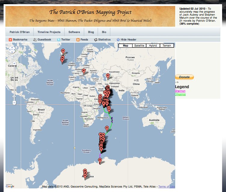
Once I had the map working in v3, I was able to take advantage of the styled maps features in v3 and give it a slightly more old world feel:
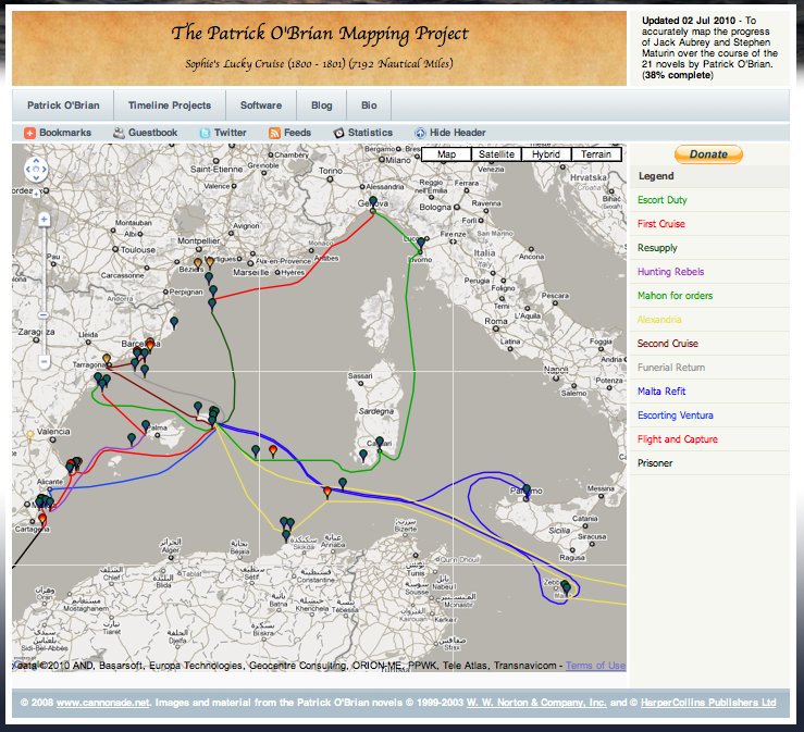
Not quite ready to make the port live, the links between info windows aren't hooked up yet, but it is almost there.
Permalink - Comments - Tags: Google,Patrick O'Brian,Development
[First Page] [Prev] Showing page 5 of 13 pages [Next] [Last Page]
 Mastadon
 Feeds
Feeds Contribute